
St. Louis County Neighbors Sources
For a block question, the county’s spatial records are the main source. Land Explorer and the Open Data service can place an address point beside parcels, lots, blocks, roads, and administrative layers. The assessor adds current property-assessment context. Older directories, census material, and historic maps can show a dated block context, while community groups supply local vocabulary and possible archival contacts. These sources are not a combined neighbor roster.
| Source | What It Shows About a Block | Access |
|---|---|---|
| County Land Explorer | Address points, parcels, map identify tools, layers, measurements, and public geographic context. | Public county map; data are supplied as-is. |
| Open Data MapServer | Parcels, lots, blocks, subdivisions, roads, addresses, districts, precincts, and polling-place layers. | Public REST service with query outputs. |
| Assessor Property Search | Address, parcel, sale, city, style, year-built, unit, and assessment-search fields. | Public county search. |
| Historic maps and directories | Dated building, street, lot, and household clues for a historic block. | Library, archive, federal, and local collections. |
| Community organizations | Neighborhood names and organization leads, not membership or residence data. | Public nonprofit and city-partner material where available. |
A parcel is the spatial unit here. A map can identify an adjacent lot or a shared block, but a name in a tax, ownership, or mailing field must remain labeled as that field. It cannot be converted into a statement that the person is a neighbor or lives there.
St. Louis County Neighbors Are Spatial
“Neighbor” has a narrow meaning in public map research: another parcel that adjoins, fronts, or lies close to the address being studied. The county’s Open Data service has separate layers for parcels, lots, blocks, subdivisions, address points, and road centerlines. Those layers reveal geometry and civic context, not friendships, household ties, or current residence. This distinction matters when a parcel is owned by an entity, uses a mailing agent, or contains more than one unit.
The county’s property systems reinforce the distinction. An owner name, tax name, tax mailing address, physical address, directory occupant, and permit applicant are different fields with different purposes. No verified county GIS field was identified as a current-occupancy field. Use an official property or map result as a location anchor, then look for dated evidence appropriate to the question.
St. Louis County Neighbors Map Flow
The county’s map tools make a reproducible path from a street address to nearby parcels. Land Explorer supports address points, Tax Parcel, Subdivision Plat, Township-Range-Section, lease PIN, bookmarks, layers, legend, basemap, draw and measure tools, location, scale, and coordinates on desktop. Mobile retains address points, bookmarks, layers, drawing, measuring, and location, but does not provide every desktop parcel or print tool.
- Enter an address or PIN in Land Explorer and confirm the physical address point. Record the map date, URL, and visible parcel label.
- Identify the subject parcel, then inspect the parcels that touch it or sit across the road. Treat every one as a separate map result.
- Read the lot, block, plat, legal description, and parcel number. These fields are better anchors than a modern street name when a road or numbering pattern changed.
- Add road centerlines, precincts, school districts, or commissioner districts only for civic geography. Use the Street Directory for the larger address-by-address street trail.
The county Land Explorer overview shows the public mapping entry point and its role in parcel research.
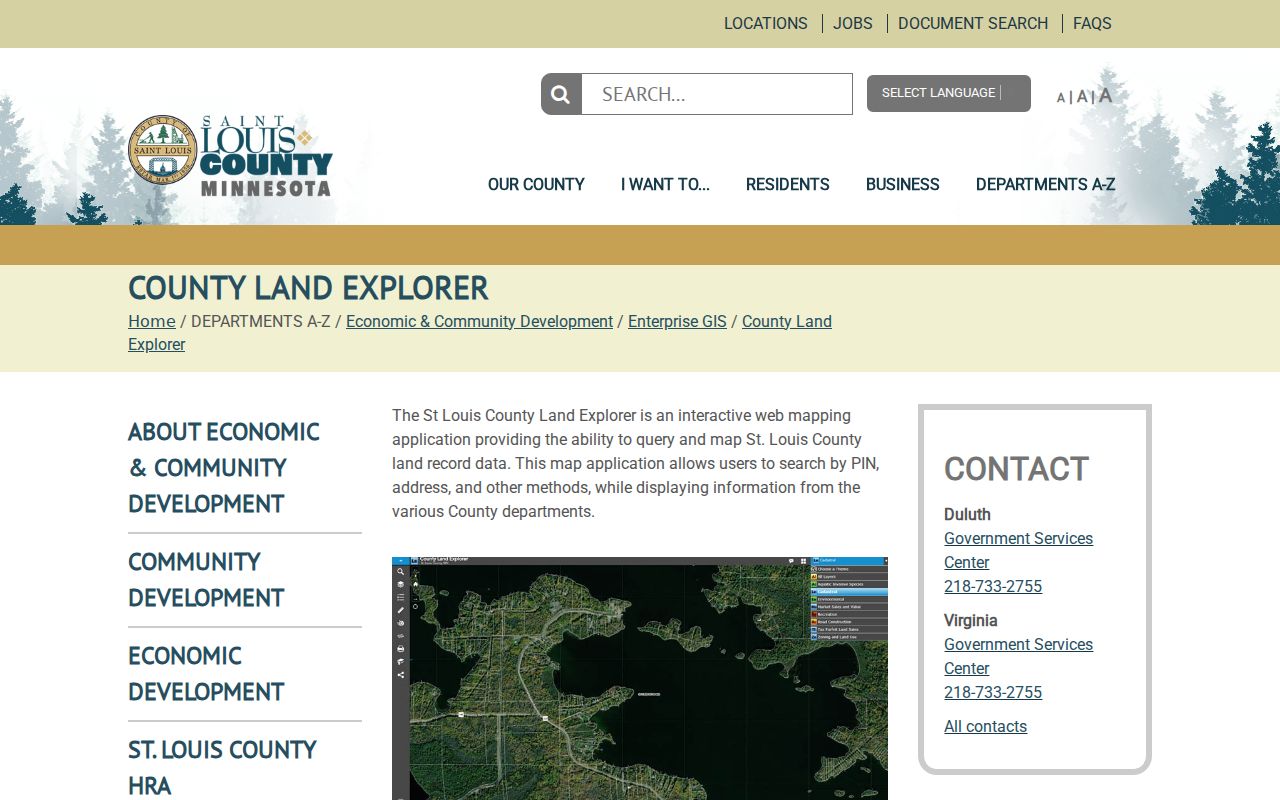
The result should be a short map log, not a bulk list of people connected to the surrounding parcels.
St. Louis County Parcel Field Roles
The official parcel-layer schema includes parcel number, acreage, ownership, owner and tax mailing fields, township, range, section, plat description, legal description, physical address, physical city and ZIP, lot and block, assessment year, school district, commissioner district, and last-sale date. It is useful for translating a visual block into fields that can be checked elsewhere.
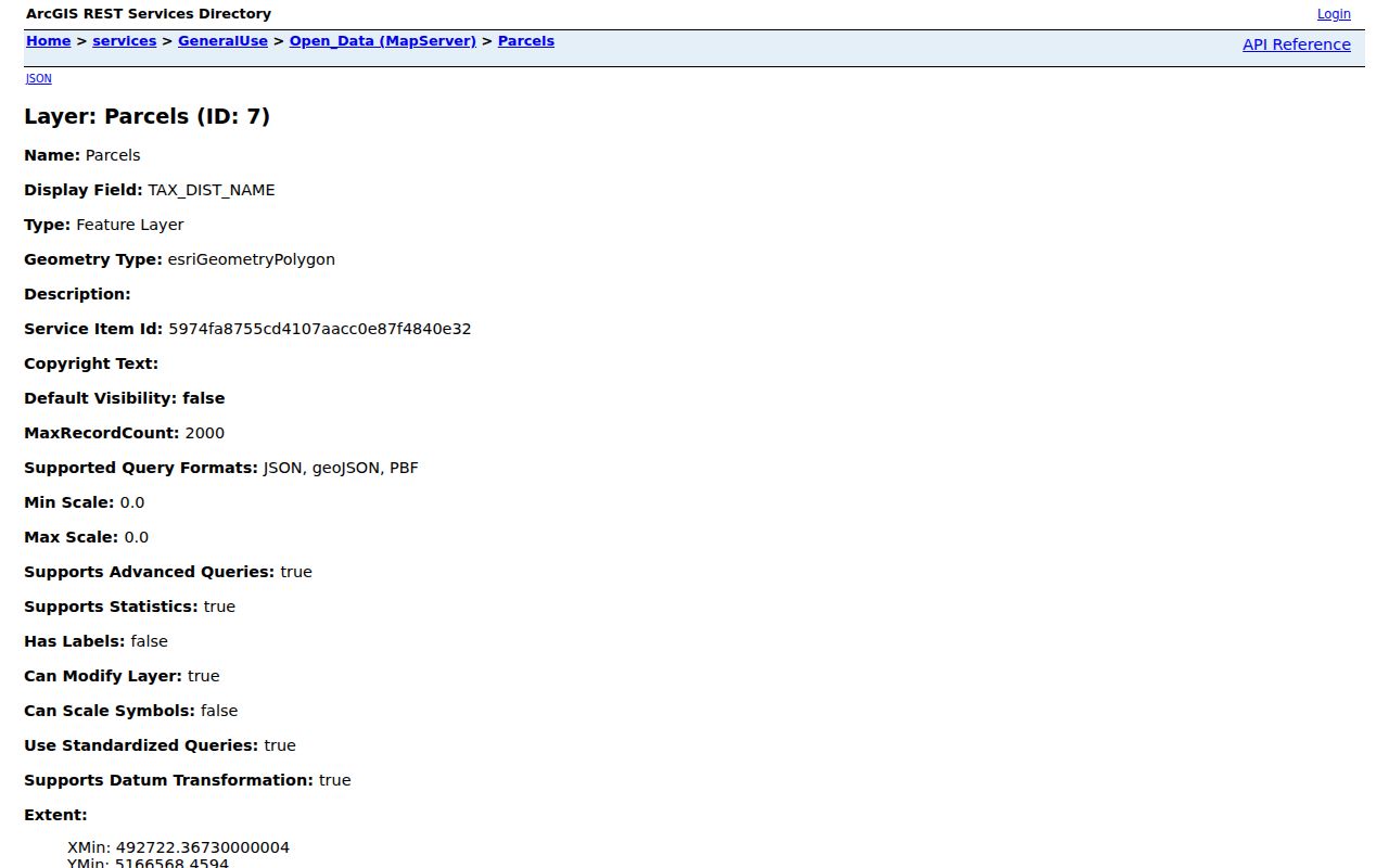
Field labels provide a safer description than an unsupported conclusion about an owner, occupant, or household.
- PHYSADDR
- The parcel’s physical-address field. It is a location field, not a verified resident name.
- OWNAME and TXNAME
- Owner and tax-name fields. They can refer to individuals, entities, agencies, or other administrative roles.
- LEGAL and PLDESC
- The legal and plat descriptions used to identify land. They help join parcel and recorded-land research.
- LOT_NBR and BLOCK_NBR
- Subdivision context that can help compare a parcel with adjacent lots or historic maps.
Note: a published field should be minimized to what is needed for the research question, with no attempt to reconstruct protected or personal details.
St. Louis County Open Data Layers
The Open Data MapServer also carries County Boundary, minor civil divisions, cadastral corners, parcels, lots, blocks, subdivisions, QQQ, quarters, sections, townships, address points, roads, zoning, school districts, commissioner districts, voting precincts, and polling places. The service metadata reports query outputs in JSON, GeoJSON, and PBF, with a maximum record count of 2,000. That is a technical access limit, not an invitation to collect a large neighbor dataset.
The county’s Open Data map service is the source for those layer descriptions and public query structure.
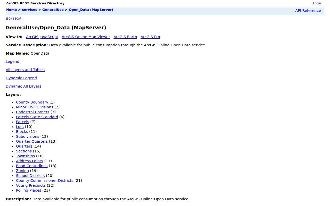
Combining an address point, a parcel, and a road layer is often enough to document the local geography without expanding into personal records.
St. Louis County Neighbors Civic Context
Map layers can add practical context without becoming a people lookup. Road centerlines help define which side of a street a parcel occupies. School and commissioner districts describe government geography. Voting precinct and polling-place layers show election-service context, but election geography changes and should be dated. The public Minnesota Pollfinder answers an address-to-polling-place question; it is not a resident directory.
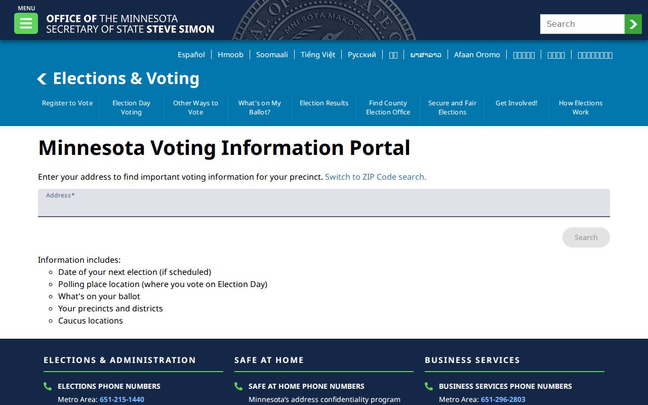
A polling-place result can support a location note for a block, not an inference about who is registered or who voted there.
Minn. Stat. § 201.091 restricts voter-list access and use. The master list is not open for general inspection, public-information-list requests carry certification and anti-publication rules, and safety withholding is available. Do not copy or publish a walking list as an online neighbor roster.
St. Louis County Neighbors History Context
Historic block work uses place sources in order. Compare a current parcel with an 1884 Sanborn sheet, the 1892 Rascher map, a 1902 or 1924 atlas, a 1930 street directory, a released census, and the county’s 1937–40 aerial layer. Each can show a different snapshot of the built environment or a dated address connection. A changed footprint, road alignment, or lot can explain why a current-address search fails.
Maps do not identify occupants. Directories become much more useful for address work with Duluth’s 1930 street-by-street listings; earlier books are mostly alphabetical. Cite the year, collection, page or sheet, and the layer date. This makes a block conclusion testable and prevents a map image from becoming a speculative story about people.
Duluth Community Geography Leads
Local names can help locate a block in its community context. Destination Duluth’s neighborhood list includes names such as Park Point, Lincoln Park, Central Hillside, East Hillside, Morgan Park, Lakeside–Lester Park, West Duluth/Denfeld, Gary-New Duluth, Fond du Lac, Piedmont Heights, Norton Park, Riverside, Spirit Valley, Woodland, and Chester Park. It is a nonprofit geographic vocabulary source, not an official boundary map or resident register.

A neighborhood label can refine a local-history search or point toward an organization, while the county GIS remains the source for official spatial layers.
| Community lead | How it can help | Important limit |
|---|---|---|
| Destination Duluth neighborhood list | Local neighborhood vocabulary for maps, archives, and event research. | Not an official boundary or population file. |
| Duluth Parks annual-report partner lists | Leads such as Lakeside–Lester Park, Central Hillside, Morgan Park/Smithville, Park Point, East Hillside, Riverside, Fond du Lac, and Gary New Duluth community groups. | Organization leads only, not membership or household data. |
| County GIS and Open Data | Official parcel, road, district, precinct, and address-point geography. | Does not identify a social group, resident, or membership. |
The research found no city-maintained searchable neighborhood-association or HOA member directory. Contact a community group only for its public local-history or civic information, and never claim that a named person is a member.
St. Louis County Neighbors Comparison
Official spatial records and community lists serve different roles. A map layer can be cited to its county source and date. A community directory or neighborhood page can supply a name used locally, but it cannot replace a parcel boundary or show membership. Treat commercial people-search categories with the same caution: their compilation, timing, and field sources are not a substitute for checking the custodian’s record.
| Source type | Best use | Do not infer |
|---|---|---|
| Official GIS | Parcel adjacency, address points, roads, and dated civic layers. | Current household membership or personal relationships. |
| Community lists | Neighborhood vocabulary, organization leads, and local context. | Official geography, membership, or who lives at an address. |
| Property and deed records | Recorded or assessment roles tied to a parcel. | Current occupancy, friendship, or a complete block roster. |
St. Louis County Neighbor Privacy Limits
Minnesota’s Government Data Practices Act, Minn. Stat. ch. 13 and § 13.03, makes government data public unless a classification law says otherwise. It does not turn every map field into unrestricted personal information. Safe at Home uses a designated address for qualifying participants, and those location protections must not be bypassed or reverse-engineered. Court, vital, and voter records each have their own access restrictions.
The county disclaims GIS accuracy and currentness, and tax/parcel results are not a survey, abstract, title opinion, or appraisal. Preserve the source URL and date, consult the responsible agency for a correction or classification question, and do not republish unneeded owner or mailing details.
Lawful use. Neighbor research is for map literacy, civic context, family or property history, and personal curiosity. Do not use public information to watch, harass, intimidate, or harm anyone.